Inquiring Readers,
For over 10 years I have searched for a full digitized copy of John Tallis’s London street views, 1838-1840. It is 328 pages long and includes an introduction with a biographical essay of Tallis by Peter Jackson.This book, digitized by Google from an original copy owned by the University of Michigan, also includes revised and enlarged views of 1847 London.
Purpose of this Blog Post:
The resources in this post are aimed at the interests of:
- Authors who are researching details of London’s streets and maps during the Regency era and Early Victorian London, as well as contemporary paintings and illustrations from that period.
- Faculty and teacher research.
- Student learning regarding research and uncovering historical details.
- Our readers’ curiosity and for those who are interested in learning more about 19th century London.
About Hathi Trust:
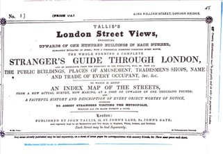
London Street Views can be found on the Hathi Trust website.
Our story:
HathiTrust was founded in 2008 as a not-for-profit collaborative of academic and research libraries now preserving 18+ million digitized items in the HathiTrust Digital Library. We offer reading access to the fullest extent allowable by U.S. and international copyright law, text and data mining tools for the entire corpus, and other emerging services based on the combined collection.”HathiTrust digital library:
The HathiTrust Digital Library is home to millions of digitized books and publications. Our team works diligently alongside research institutions to preserve and grow this collection while providing lawful access to visitors around the world.”
This link leads directly to London Street Views
This very useful site also offers links to many more books from the past, where you’ll find a rich source of 18+ million unique and historic books that have been digitized. Forty per cent can be read by the public, and copyrights and access are explicitly explained. See “How to Search and Access.”
In addition:
Find thousands of Images at the London Picture Archive, which is managed by The London Archives on behalf of the City of LondonCorporation.
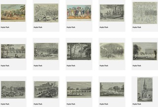
For Example, when I typed “Hyde Park” in this site’s search bar, a wealth of images appeared that gave life to Austen’s era. Combined with the Tallis maps, these resources provide a more comprehensive view of life during the Regency era as it was, as opposed to reproductions in today’s film sets, lets say. (Also see Horwood’s Maps in the link at the end of this post.)
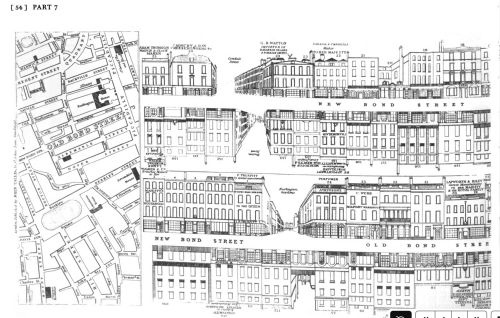
New Bond Street
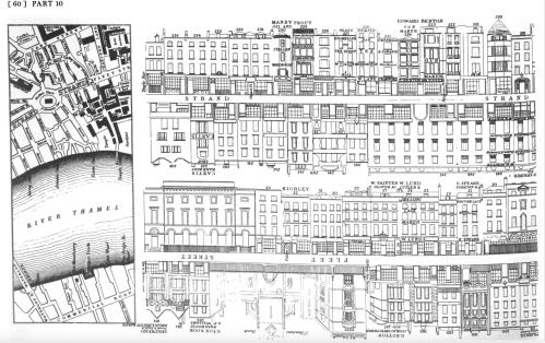
River Thames
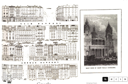
West view of St. Paul’s Cathedral and surrounding streets
Who is John Tallis?:
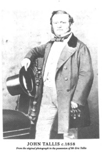
John Tallis: 1816-1876
The biographic introduction to this book by Peter Jackson includes a vast amount of information about his life. (Image @ Hathi Trust)
Other information about Tallis:
“The Life of John Tallis – Map Maker and Cartographer”: biography excerpt from the Old Maps Library blog
“Tallis … produced a series of street views of central London that are breathtaking. His images showed detailed views of the streets using the facades of the buildings. These street views are much like we use Google street view today, giving us a sense of what the city looked like in the early Victorian era.”
“Tallis was born in Stourbridge, Worcestershire in 1817, and moved to London in about 1841… A blue plaque commemorates his final residence at 233, New Cross Road. He died in 3 June 1876.”
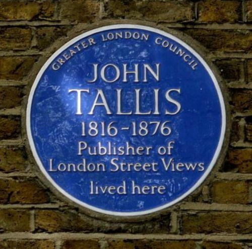
Memorial Plaque. Image of his house as well @ London Remembers
More information about London Streets in this blog:
Horwood’s 1804 Map of London, blog post published 2021 on this site.


OMG only comes close. Stunning. Thank you.
You are welcome. I was so happy to find a digitized online version of this book. Thanks for stopping by.
What an incredible resource. So beautiful to see!!!
Thank you, Rachel. I’ve tried to find this resource in digitized form for years, and voila! It happened by accident! John Tallis was born a year before Austen’s death. I imagine that Cassandra, her sister, who lived until her seventies, would have recognized many buildings depicted in these London streets.
Wow. What a great find. I have added the link to the Wikipedia article on John Tallis.
Thank you so much! This is very helpful.
Another excellent resource from that time period is “A New System of Practical Domestic Economy” which is basically a guide to household budgeting, incomes and the cost of living for all manner of goods and services.
https://books.google.com/books?id=ifdAAQAAMAAJ&printsec=frontcover&source=gbs_ge_summary_r&cad=0
Thank you!!
This is great. I have seen some of Tallis’s street illustrations displayed in The Museum of London. I have had a quick glance through some of the pages. The Biography of John Tallis is very interesting, Vic. His first business premise was at 15 St Johns Lane and he later moved a short distance to 40 St Johns Street. That area, just north of Smithfield Market has so many layers of history. Its south of Clerkenwell and not far from Shoreditch where the museum I volunteer at is located. I have walked, probably, most if not all of the streets in his directory. It was interesting to look through the ,”List of Parts,” which provides the street names and then there is the ,”Street Directories,” which name the business at each building in every street. An amazing feat of work. Probably there are a number, but not many, of the buildings he illustrates still standing today. Thanks for posting this. I will definitely come back to it.
It reminds me a little of Charles Booths poverty map that was produced in the late 1890s that illustrates maps of London with a colour coded system showing the classes , poor to rich that inhabited every street in London.
Tony
As always, Tony, your analysis and expertise with all matters London and British, add so much depth to my research. This digitized volume is priceless. Thanks for your views. Vic
Wow!
denise
So happy I found it, Denise